Avenza Trail App
We have created a mobile PDF map that utilizes the GPS functionality of your phone to chart where you are on our trail system, and can even track distances skied and snowshoed throughout your visit. The app and maps are FREE! We recommend that you download the Avenza Trail App on your phone so you will never get lost again! This app does not use your data while in use on trails but you should be on wi-fi to download the app and maps to reduce data consumption.


- Login to your Avenza Maps account
- Tap maps to download to your device
- Search for our free “Sovereign Lake” maps for all the latest available geo-referenced maps available for our area.
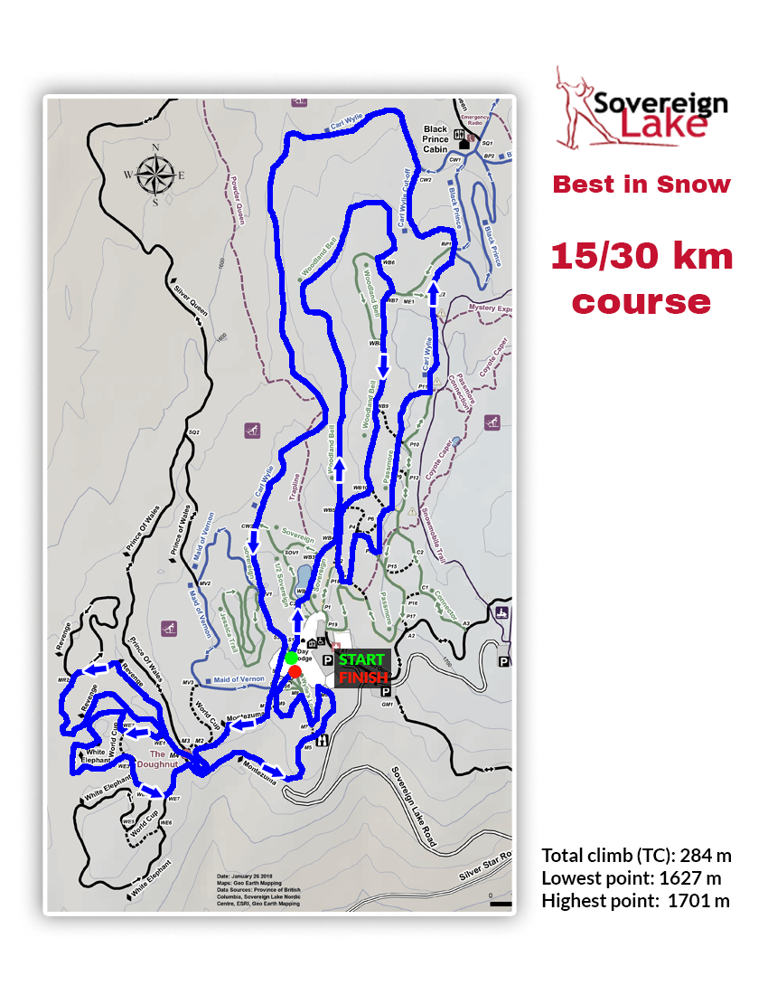
Downloadable Trail Maps


